Antique Decorative World Map Art Print, vintage cartography, study or office decor, travel gift, history lover gift
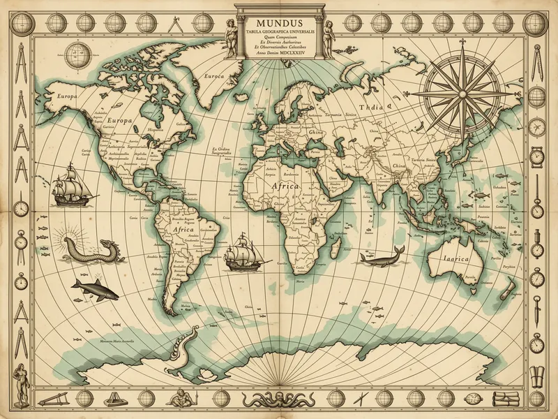
Antique decorative world map art print presents all continents in a vintage 17th-century cartography style, with fine engraved detail, an ornate compass rose, galleons, sea serpents and whales. The warm sepia parchment tones, subtle teal oceans and Latin place names create a vintage composition. Printed on Enhanced Matte Paper (189 g/m²), it suits a study, library, office, or travel-themed room and makes a useful gift for map and history enthusiasts.
The eye meets a broad, balanced composition of continents, coastlines and open water, drawn in fine engraved lines that give every region a measured, etched texture. Warm sepia and parchment beige shape the land and surrounding border, while muted teal oceans provide a restrained contrast without breaking the antique palette. Latin place names sit closely along the coastlines and within the landmasses, inviting a slower look at Europe, Asia, Africa, the Americas and the southern reaches of the map. Around the central geography, an ornate compass rose adds a strong geometric point, with its radiating points and circular detailing. Small galleons move across the water, accompanied by curling sea serpents and whales that bring the margins to life. The result is detailed but orderly: a rectangular field of fine lines, curved coastlines, serif lettering and small maritime forms, all held together by the subdued colours of aged parchment and oxidised teal.
Its visual language belongs to the tradition of 17th-century decorative cartography, when maps were made to describe geography while also filling the page with maritime imagery, ornamental lettering and symbolic detail. A clear marker of that tradition is the elaborate compass rose, used not simply as a directional guide but as a focal ornament with layered rings, points and fine radial lines. The sailing ships, whales and sea serpents continue this old mapmaking habit of giving the oceans their own visual character, turning empty water into a scene to explore. The Latin names reinforce the scholarly atmosphere, making the print feel at home among atlases, globes and reference books. Rather than presenting a modern, minimal diagram, it offers a richly worked surface: land is defined by engraved contours, the seas are broken by decorative figures, and the surrounding details reward anyone who enjoys geography, navigation or the material look of historic maps.
This print suits a study, library, home office or travel-themed room where its sepia tones can sit comfortably with walnut, oak, leather, linen and dark painted furniture. Hang it above a writing desk, beside a bookcase, or on a wall shared with a globe, framed postcards or shelves of travel and history books. The generous rectangular composition works well as a central piece, while the fine details make it worth placing where viewers can stand close enough to read the labels and follow the coastlines. Soft daylight brings out the contrast between parchment-coloured land and teal water; a warm table lamp or directional wall light can do the same in the evening, especially against a cream, sand, olive or muted blue wall. On a white wall, the darker border and engraved lines give the arrangement definition. It can mark a quiet reading corner, add geographic character to an office, or serve as a considered gift for someone drawn to maps, maritime imagery and the visual language of history.
“Old-world cartographic detail, from compass roses to galleons, brings a quiet scholarly mood to a study wall.”
- SubjectContinents rendered in classic 17th century engraving style, with ornate compass roses, sea creatures, and galleons.
- Palette & lightWarm sepia landmasses contrast with a soft teal ocean on enhanced matte paper, evenly lit.
- CompositionA balanced world projection with decorative cartouches and small vessels that reward close looking.
- Where it fitsA home office, private library, or study where a touch of old-world atmosphere feels right.
| Material | Enhanced Matte Paper (189 g/m²) |
| Digital printing | |
| Care | Frame or mount out of direct sunlight; wipe gently with a dry, soft cloth. |
| Shipping | Made to order — ships in 2–5 business days |